Showing posts with label travel. Show all posts

Sunday, August 25, 2013

Mohammad Hosayn Farahani's Hajj Travel Route (1885-86)


View Mohammad Hosayn Farahani's Hajj Travel Route (1885-86) in a larger map

Adopted from "The Safarnameh of Mirza Mohammad Hosayn Farahani", from his pilgrimage in 1885-1886.

Farahani's journey to Mecca not only fulfills his pilgrimage obligation but also provides a detailed guidebook for his contemporary Persians needed for their Hajj travels. Thanks to the introduction of railroads between Baku and Batumi, Farahani takes the unconventional route to Mecca, traveling first to Batumi via train and then going to Istanbul by boat stopping along the route in several cities such as Trabzon and Sinop. After Istanbul, he continues his journey by boat to reach Alexandria over the Aegean Sea and from thereon to Jidda via Suez Canal. His return trip was also from the same route and his book was considered to be Guide Michelin of his time for round-trip Persian Hajj.

Wednesday, June 26, 2013

Map of Nasir Khusraw's Travels (1046-1052)


View Nasir Khusraw's Travels (1046-1052) in a larger map


Adapted from the Naser-e Khosraw's Book of Travels, W. M. Thackston, Jr. New York, 1986

Nasir Khusraw's Safarname (Book of Travels) has been a classical text for Persian travel writing for the last 1000 years. Confessing that his travels are due to mid life crisis, he set out for Mecca at the age 42 after seeing a dream while in a drunk situation. In his dream, he was pointed the qibla direction (Mecca) when he asks about where the wisdom lays. Following this, he resolves to go for Hajj and rather immediately sets our for Mecca. For the next seven years, he travels through Persia, West Azerbaijan, Turkey, Syria, Cairo, Hijaz, Hafsa and Basra region. 

Saturday, December 15, 2012

Nesmith Point Hike

We started around 6.30 am for the hike. Hiked uphill until 9.30 and stopped to have the breakfast. Then started our descent. Trail was full of snow after 1500 ft.


Monday, December 10, 2012

Wahclella Falls - Highway State Trail Hike

Wahclella Falls - Highway State Trail


Snapshots:
Our GPS log overlayed on Google Earth:


Saturday, November 24, 2012

Arnavutluk Rozafa Kalesinden Ezan

Enver Hocanın altında onca yıl din yasaklanmasına rağmen, o yasaklayıcı zihniyete inat ezan Shkoder semalarında eskiden olduğu gibi yankılanıyor.


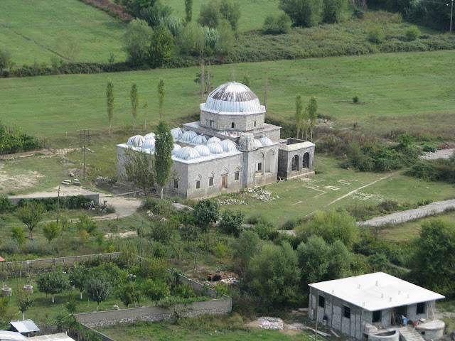
An old Ottoman mosque (Lead Mosque- Kurşunlu Camii) in Shkoder as seen from Rozafa Castle. The minaret has been exploded due to lightning struck.


View of Rozafa Castle as seen from airplane right after Podgorica airport

Sunday, November 18, 2012

Getting to Skopje city center from the Alexander the Great Airport

The main getaway to Macedonia is Alexander The Great Airport in the outskirts of Skopje. It is relatively small but definitely modern and very clean. It is built by the Turkish TAV (Tepe-Akfen-Vie) company which also built the airports in Istanbul.So, internal architecture-wise this airport is very similar to those in Istanbul. Once you reach the airport, there are several ways to get to the city center. I just want to briefly mention them.

There are many taxis waiting outside the airport.

There is also furgons operated by Vardar Express. The price to city center is 100 MK Dinar which is around 2.1 US$.

Here is the ticket for Vardar Express. There are several stops along the route. It also passes through the international bus station. Getting off around Hotel Holiday Inn is enough for walking to the historical old city, Stari Grad.

Just out of the airport, the roads looked good. Evidently, the Macedonian government is trying to beautify the country.


Right between the airport and city center, there is the municipality called Gazi Baba.

Halkbank was a big hit over there. All the billboards were full with their advertisements. Also Acibadem hospital was exhibiting itself everywhere.

Tuesday, October 23, 2012

Podgorica-Istanbul Flight

Podgorica-Istanbul Flight


This is recorded during the Turkish Airlines flight (TK1086) from Podgorica, Montenegro to Istanbul, Turkey using my Sony GPS-CS3KA gps tool. With relatively clear skies, I was able to capture snapshots during this short Balkan flight. Right after take off, the plane headed towards Albanian border and flown over the Lake Shkoder. Those sitting on the right side of the plane were lucky enough to clearly see the city of Shkoder and its landmark Rozafa Castle. 


Friday, October 19, 2012

How to get from Ohrid to Tirana by public transportation?

When I decided to have a short Balkan trip, I decided to start from Skopje and move onwards to Tetovo and Ohrid. Once Ohrid is completed, I planned to go to Tirana, Albania and keep going to Montenegro over Shkoder. As I was searching the internet for various possibilities to travel between Ohrid to Tirana, I could not find satisfactory information. Apparently, there was no direct bus connection between these two cities and suggestions were mainly on taking taxis to the border and then catch a bus or another taxi to Elbasan. So, once I reached Ohrid, I didn't know how to get to Tirana the next day. Thus, I decided to prepare this post to help people searching for this information as well as increase content on Albania in the internet domain. (Note that all these info is based on data from October 2012 and check for updates where necessary.)

Well, for the best information, I asked locals once I get to Ohrid. The main suggestion is to take the mini-buses to Struga on the north shores of Ohrid lake and then catch a inter-city bus coming from Skopje outbound to Tirana in the main bus station in Struga. I was told that if I may miss the mid-noon buses then I might have to wait for 5-6 pm buses leading to late arrival to Tirana.Note that there is no direct bus line originating from Struga going to Albania. All the buses I have seen were coming from elsewhere, such as Skopje, Kumanovo and even Istanbul.

This is an "insider's" view from the mini-bus between Ohrid to Struga. It takes approximately 15 minutes to get to Struga from the main boulevard of Ohrid. It is very easy to spot the minibus if you just wait near the road. Even private cars stop and ask whether you need a ride or not.
 
Once in Struga, you should get off the minibus around the following tiny church St.Petka (yellow marker in the below map). Actually, in the below photo, you can see a similar minibus coming to the bus station and people waiting for the minibus. If you keep in the minibus, its route gets farther from the main intercity bus station. Once out, keep walking toward the city and turn right and keep going. Check the map below for further details:


The front side of the bus station looks like as shown below. It is very small bus station and mainly the buses comes, picks up passengers and leaves. Note that the bus station is squeezed between industrial shops. So, while getting there, it feels like there cannot be a bus station but believe me there is one.


Inside the bus station, I have seen this bus going to Istanbul over Bulgaria. I believe if there wasn't a need for a transit visa from Bulgaria to get to Macedonia, many people from Turkey would take this bus trip. It is very cheap compared to flight tickets and you get to see different cities along the way. 

This is the bus stop for Istanbul. Note the way they write Istanbul: Istambul. I cannot say this is a typo as some countries including Spain write Istanbul the same way as below.

The other perons of the bus station

Finally our bus arrived from Skopje. It stopped for a very short duration. After picking up the passengers it hit the road. The next destination is the Albanian border.

We are at the Albanian border. It took approximately half an hour to clear from both countries. First the Macedonian side collects the passports and they stamp out. Then, Albanian border police gets the passport and stamp in. As passengers, we did not interact with the border police at all. The bus driver took care of everything. Unfortunately, stamps were barely visible due to almost no ink on the stamps.


This is the inside view from our bus to Tirana. There was this nice old man who kept the cigarette in his mouth until he get off while waiting for the customs for the passport or IDs. He was calm and definitely cool.


Saturday, September 01, 2012

Cape Lookout Hike


This hike was in my to-do-list for a long while, but I was not able to find the time to go and get it done. Finally, today I was able to see it. The best part was that my 1-year old Meryem and 4.5 half year old Omer were with us as well. This was Omer's second and Meryem's first hike. Omer walked all the way by himself and Meryem enjoyed being carried by her mom and dad. As for the trail status, occasionally it was muddy. Except for the very steep cliff on the end of the trail, it is very family friendly and easy paced.

I did geotagging using the Sony GPS-CV3KA and the accuracy was overall satisfactory. I also had my Samsung Google Nexus S geotag using the Google "My Tracks" app. But it was having trouble in getting the GPS satellite connection. So, dedicated GPS machines still seem to perform more accurately than the smartphones (at least from my experience). Below are snapshots of our track overlayed onto Google Earth and maps.


Friday, March 16, 2012

Mount St. Helens Trip, Oregon

Mount St. Helens


The famous (or notorious) volcanic eruption of the Mt. St. Helens in 1980 had been on the headlines for a long time. After 31 years, we did a trip to see the landscape ourselves.


Monday, August 08, 2011

Adventures of Ibn Battuta: India

Saturday, July 30, 2011

Adventures of Ibn Battuta: Anatolia and Crimea

Sunday, July 17, 2011

A Tentative Map for Ibn Battuta's Travel in Black Africa and Andalusia


View Adventures of Ibn Battuta : Black Africa and Andalusia Section in a larger map

This post is in draft version. It will hopefully be expanded later.


References:
1 - The Adventures of Ibn Battuta, Ross E. Dunn, University of California Press, Revised Edition, 2005, pp.277
2 - Ibn Battuta and his Saharan Travels

Thursday, May 05, 2011

Sony GPS-CS3 Geo-tagging Performance in Wilson River Trail, Oregon


Last week, I had the chance to go for a short hiking trip on the Tillamook region of Oregon. Specifically, we aimed for the Wilson River Trail. The track was rather narrow so while going back and forth we passed from the same route with a great probability. However, as can be seen in the above snapshots, the geotags for the round trip do not overlap to each other. We can easily see two distinct routes for forward and backward directions. This is kind of disappointing for the performance of the GPS as at some points 5 meters of deviations exist.

Thursday, March 31, 2011

Crossing the bridge - Ponte 25 de Abril


This is from my recent trip to Lisbon, Portugal. I was able to catch the evening commuter train to the other side of the Targus River. A beautiful city that deserves more time to spend.

Monday, February 01, 2010

Driving in Sri Lanka

During a recent trip to Sri Lanka, I traveled with a friend and rented a car. The country has a stunning nature. The people are very friendly. However, the traffic and roads were very bad in many parts of the country. There was only a small section between Colombo and Dambulla that the road was paved nicely. I recorded the following video from the road.

Monday, January 30, 2006

Travnik ve Günlüğü

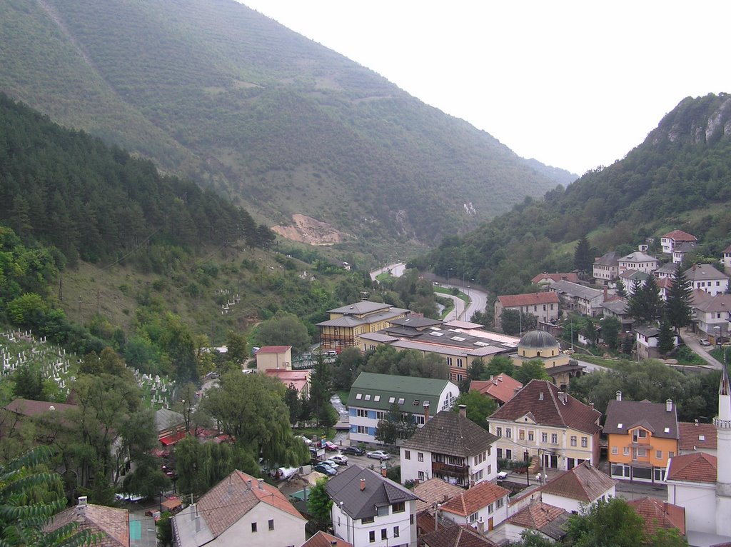
Bosna deyince meraklıların ya da ilgilenenlerin dışında akla pek gelmeyen bir şehir Travnik... Oysa tarihde bir zamanlar "Bosnanın İstanbulu" lakabını bile almış köklü ve şirin bir şehir.... Osmanlı zamanında Bosna eyalatinin başkenti olmasından ötürü tarihsel anlamda çok zengin aynı zamanda bir o kadar da çekici bir doğa güzelliğine sahip... Saraybosnadan Zagreb yönünde 1.5 saatlik mesafede olup yandaki resimde görüldüğü gibi ani bir virajdan sonra ortaya çıkıveren şimdinin ne yazık ki biraz unutulmuş şehri... Bu şehir ile tanışmam şehre büyük sevgi duyan Ivo Andriç’in Drina Köprüsünün dışındaki çalışmalarını da merak edip Travnik Günlüğü adlı kitabını bulmamla başladı. 1807 yılında Fransız konsolosunun şehre ilk defa gelmesinin ve de onu bir yıl sonra da Avusturya konsolosunun takip etmesinin hem müslüman halkın hem de gayrı-müslümlerin gözünden anlatıldığı kitapta zamanın tarihsel gerçekleri (Napolyonun seferleri, Sultan III. Selimin tahttan indirilmesi gibi) ve çesitli insan portreleri kısa hikayelerle birbirine bağlanıp esas kitabı oluşturuyor. Bir nevi, Balkanların o devirden kalma bir fotoğrafıymış diyebileceğimiz bir kitap... Meraklısı için kesinlikle ilgi çekici ve de (biraz da ilgili tarihsel konular okunduktan sonra) öğretici bir kitap...

Kitabın yanısıra biraz da şehrin şu andaki halinden bahsetmek istiyorum. Kitabın da etkisiyle bu yaz orayı görme fırsatım oldu ve ilk olarak söyleyebileceğim
eğer bir gün yolunuz Saraybosnaya düşecek olursa Travnik’i görmeden gitmeyin…Hem yakınlık hem de ulaşımın rahat olması günübirlik bir geziyle şehrin hemen hemen her yerini görme imkanı verecektir. Ha bu arada Saraybosna ya da Mostarda alacağınız hediyeliklerin yarı fiyatına satıldığını göreceginiz için buraya uğramadan hediyelik almayın…Şimdi gelelim gezilecek yerlere… Tabi ki öncelikle tarihi kaleye çıkıp şehri tepeden izlemek şart... Etrafta bolca bulunan derelerin şırıltısını dinlemek için bile kaleye çıkmaya değer.. Tabi bir de hemen çıkışın başındaki kahvelerde Boşnak kahvesinin de zevki bir başka… Kaleden bakmaya doyduktan sonra yavaş yavaş şehrin içinde gezintiye çıktığınızda eski camileri ve de saat kulelerini göreceksiniz. Sakın şasırmayın kendinizi Üsküdardaymış gibi hissedebilirsiniz. Ama arka plandaki dik ve yeşil dağlar buranın farklı olduğunu hissettirecektir. Ayrıca meraklıysanız pazarında mücahitlerle tanışıp üzümlerini yiyebilirsiniz. Bosnanın diğer bölgelerinde olduğu gibi Travnikde de bir çok yeni mezar savaşı hemen hatırlatıyor ve insanı kederlendiriyor. Camilerden özellikle Renkli Cami olarak da bilinen Süleymaniye Camisi altındaki bezistanlarla birlikte görülmeye değer. Yine meraklısı için Ivo Andriç’in doğduğu ev olan ama simdi hem müze hem de restoran olarak kullanılan yerde güzel bir yemek de yenebilir. Bunların dışında turistik bir kent olmamasından ötürü ingilizce konuşacak insan bulması zor olsa da insanları, hayatlarını ve de yaşam tarzlarını daha yakından tanıma imkanını bulabiliyorsunuz.
Kitapdan bir alıntı:
- Travnik Çarşısının sonunda, gürül gürül akan serin Sumeç Suyunun alt yanında, hangi devirden kaldığı iyice bilinmeyen “Lütfiyanın Kahvesi” adlı küçük bir yer vardır. Buranın ilk sahibi Lütfiyayı, kasabasının en yaşlıları bile hatırlamıyorlar. Bu Lütfiya, Travnikin dört bir yanına serpilmiş olan mezarlıklardan birinde son uykusunda yatalı yüzyılı aşmış bulunmasına rağmen, herkes kahvesini içmek için Lütfiyaya gitmekte, birçok sultanların, vezirlerin, beylerin adları unutulduğu halde, onun adı anılmakta ve dillerde dolaşmaktadır.