Finally, we had an opportunity to have a family hike this summer. My son, Omer and my daughter, Meryem were with us as well. Omer was walking by himself and Meryem was comfortably carried in my back. After a pleasant hour of walking starting from the south trailhead, we reached to the top of Neahkahnie Mountain. The view of the Nehalem Bay and the Pacific Ocean was stunning. Omer was happy to be at the top and couldn't help but took his selfie.
We started on Friday around 7 pm and keep walking until the sun set
around 8.10. Found a nice camping spot next to the river and setup the
tents. Thanks to the tall trees and no moon, the camp site was pitch
black making it a different experience. Had our dinner and went to sleep
around 10.30 pm. Woke up at 4.30, had breakfast and started walking up.
The weather and the trail were nice. There was snow after 3500 ft but
it was okay. We reached the Sherard's point at Larch Mountain at 8.30
am. The view was worth the climb. Except Mt. Rainier, all major
mountains were visible (Mt. Hood, Mt. Jefferson, Mt. St. Helens and Mt.
St Adams)
We reached the trailhead around 6.30 and started to hike around 7 am under 0 celcius. The pipes of the waterpacks got frozen, so needed to use the bottle for the water need. Reached the peak around 9.30 am and started descending until we found a nice spot for the breakfast.
We reached the trailhead around 6.30 am and started to hike at 7.00 am.
The trail was full of frozen snow making it difficult to walk at some
points. Reached the summit around 9 am and had our breakfast. Then we
started the descent and reached the trailhead around 11 am.King's Mountain on EveryTrail
We reached the trailhead around 7.10 am and got prepared. Started to
hike around 7.30 am and hiked until 9.00 am. Had our breakfast and head
back to trailhead. Mt. Hood was clearly visible when we started but
later it was covered with cloud and not visible. GPS machine stopped
working after a while so the track is not complete. I tried to complete
it myself hence there is no accurate information after 3.5 km of the
track.
We started around 6.30 am to hike aiming to reach North Lake. By 9.30, had our breakfast and kept going. Almost one mile away from North Lake, decided to head back. The trail was full of snow after approximately 1500 ft. Nice view of Columbia Gorge can be seen. On a sunny day, this trail should be a terrific hike. Here is the hike log and some photos:
We started around 6.30 am for the hike. Hiked uphill until 9.30 and stopped to have the breakfast. Then started our descent. Trail was full of snow after 1500 ft.
This hike was in my to-do-list for a long while, but I was not able to find the time to go and get it done. Finally, today I was able to see it. The best part was that my 1-year old Meryem and 4.5 half year old Omer were with us as well. This was Omer's second and Meryem's first hike. Omer walked all the way by himself and Meryem enjoyed being carried by her mom and dad. As for the trail status, occasionally it was muddy. Except for the very steep cliff on the end of the trail, it is very family friendly and easy paced.
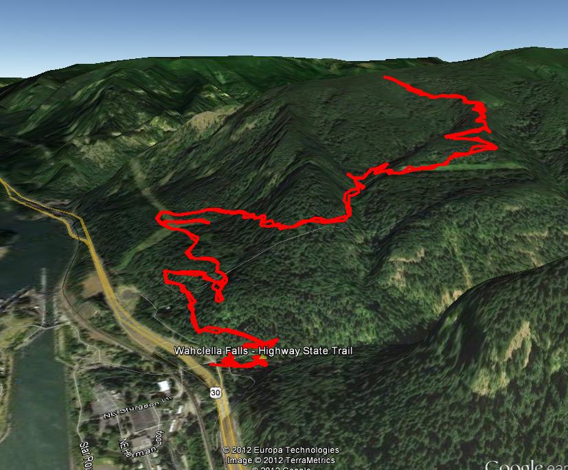
I did geotagging using the Sony GPS-CV3KA and the accuracy was overall satisfactory. I also had my Samsung Google Nexus S geotag using the Google "My Tracks" app. But it was having trouble in getting the GPS satellite connection. So, dedicated GPS machines still seem to perform more accurately than the smartphones (at least from my experience). Below are snapshots of our track overlayed onto Google Earth and maps.
Omer loves biking... and I am looking for ways to utilize the GoPro camera as much as possible. So, I decided to combine these two together. I didn't have the right gadget to mount the GoPro into Omer's bike so we did some manual work. After a couple of tries, I believe we got a nice shot.
The famous (or notorious) volcanic eruption of the Mt. St. Helens in 1980 had been on the headlines for a long time. After 31 years, we did a trip to see the landscape ourselves.
This was yet another hike with our hiking club during weekday after the job. Trail can be very steep at some points. But the view at the summit deserves that struggle. Definitely lovely view from the top. Descending is way more difficult than ascending. So caution should be practiced.
Last week, I had the chance to go for a short hiking trip on the Tillamook region of Oregon. Specifically, we aimed for the Wilson River Trail. The track was rather narrow so while going back and forth we passed from the same route with a great probability. However, as can be seen in the above snapshots, the geotags for the round trip do not overlap to each other. We can easily see two distinct routes for forward and backward directions. This is kind of disappointing for the performance of the GPS as at some points 5 meters of deviations exist.